


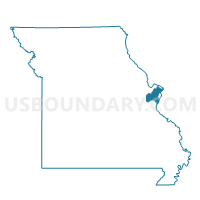
NW044 Voting District, St. Louis County, Missouri
About
Outline

Summary
| Unique Area Identifier | 610198 |
| Name | NW044 Voting District |
| County | St. Louis County |
| State | Missouri |
| Area (square miles) | 4.16 |
| Land Area (square miles) | 3.74 |
| Water Area (square miles) | 0.42 |
| % of Land Area | 89.85 |
| % of Water Area | 10.15 |
| Latitude of the Internal Point | 38.78660070 |
| Longtitude of the Internal Point | -90.43234260 |
Maps


Graphs
Select a template below for downloading or customizing gragh for NW044 Voting District, St. Louis County, Missouri


Neighbors
Neighoring Voting District (by Name) Neighboring Voting District on the Map
- 001-Kampville Voting District, St. Charles County, MO
- 045-Mamelle Voting District, St. Charles County, MO
- NW006 Voting District, St. Louis County, MO
- NW018 Voting District, St. Louis County, MO
- NW027 Voting District, St. Louis County, MO
- NW029 Voting District, St. Louis County, MO
- NW041 Voting District, St. Louis County, MO
- NW042 Voting District, St. Louis County, MO
- NW050 Voting District, St. Louis County, MO
- NW202 Voting District, St. Louis County, MO
- NW205 Voting District, St. Louis County, MO
- NW208 Voting District, St. Louis County, MO
- NW229 Voting District, St. Louis County, MO
Top 10 Neighboring County Subdivision (by Population) Neighboring County Subdivision on the Map
Top 10 Neighboring Place (by Population) Neighboring Place on the Map
Top 10 Neighboring Unified School District (by Population) Neighboring Unified School District on the Map
- Hazelwood School District, MO (118,853)
- St. Charles R-VI School District, MO (53,421)
- Pattonville School District, MO (41,088)
- St. Charles County R-V School District, MO (10,607)
Top 10 Neighboring State Legislative District Lower Chamber (by Population) Neighboring State Legislative District Lower Chamber on the Map
Top 10 Neighboring State Legislative District Upper Chamber (by Population) Neighboring State Legislative District Upper Chamber on the Map
Top 10 Neighboring 111th Congressional District (by Population) Neighboring 111th Congressional District on the Map
Top 10 Neighboring Census Tract (by Population) Neighboring Census Tract on the Map
- Census Tract 2114.01, St. Louis County, MO (5,329)
- Census Tract 3101, St. Charles County, MO (2,342)
- Census Tract 2131.02, St. Louis County, MO (411)